
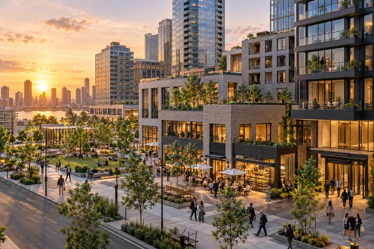
Picture a city block where you can grab coffee downstairs, walk to work, stop by a small park, and pick up groceries on your way home.
Sounds pretty convenient, right? Now imagine fitting all of that into a limited urban site without creating traffic chaos, dark streets, or a wall of disconnected towers.
That is where mixed-use master planning strategies for high-density urban sites become essential. The idea goes beyond stacking apartments over shops or placing an office beside a hotel.
A strong master plan organizes buildings, streets, open spaces, infrastructure, and everyday experiences into one connected urban district.
As cities grow and available land becomes harder to find, thoughtful density matters more than ever. The challenge is not simply squeezing in more floor area; it is making each square meter work harder while keeping the place comfortable, inclusive, and financially realistic.
Whether you are an architect, developer, planner, or just curious about how modern urban districts come together, these seven strategies explain what makes a compact mixed-use neighborhood genuinely work.
1. Start With the Site, Not the Skyline
Read the Urban Context Before Drawing Towers
It is tempting to start a high-density project with dramatic building silhouettes. But the smartest master plans begin at ground level, looking carefully at the city that already exists around the site.
Study nearby streets, public transport, surrounding building heights, pedestrian routes, local businesses, and public facilities. Also map less glamorous realities such as flood exposure, utility capacity, delivery access, and neighboring properties that may change in the future.
A site beside a commuter rail station needs a different strategy from one surrounded by small residential streets. The first might support higher job density and fewer parking spaces, while the second may need quieter edges, smaller storefronts, and a gentler transition in height.
Test Several Development Scenarios
Create at least three early massing options instead of falling in love with the first one. Compare each for usable floor area, daylight, wind comfort, public space, estimated infrastructure cost, and the experience of walking through it.
For example, two very tall towers could produce a similar total floor area to four slimmer buildings around a shared courtyard. But their shadows, elevator demands, street activity, and phasing options may look completely different.
An early scenario matrix makes these trade-offs visible before design decisions become expensive. Think of it as checking the foundations of the business case and the public realm at the same time.
2. Create a Land-Use Mix That Works All Day
Balance Destinations, Not Just Percentages
Putting housing, offices, retail, and leisure uses on the same plot does not automatically create an active district. The real question is whether their schedules, audiences, and daily needs complement one another.
Offices bring weekday activity, homes support evenings and weekends, and grocery stores serve both. Schools, clinics, fitness spaces, and childcare can fill important gaps while making the area more useful for different age groups.
A simple exercise is to sketch an hourly activity chart from 6 a.m. to midnight. If everything goes quiet after office workers leave, your mix probably needs adjustment.
If nightlife dominates beneath family apartments, you may need better separation of entrances, noise control, and operating hours.
Mix Vertically, but Protect Each Use
Vertical mixed-use development can be a great way to save land: shops at street level, offices or community facilities above, and homes on upper floors. Still, sharing a building does not mean sharing every corridor, lift, or loading bay.
Give residential occupants secure access and privacy, keep restaurant exhaust away from windows, and separate service deliveries from pedestrian entrances.
Flexible floor plates are helpful too, since today’s coworking space could become tomorrow’s clinic or learning center if regulations and structure allow.
The best mix should also include different price points. A neigborhood made entirely of luxury apartments and expensive restaurants may look polished, but it will struggle to serve the broader community or maintain a truly varied street life.
3. Make Walkability the Backbone of the Master Plan
Build Short, Direct Routes Between Daily Needs
A beautiful development can still feel inconvenient if people have to walk around oversized blocks, parking ramps, or fenced-off podiums. Pedestrian routes should be obvious, continuous, accessible, and ideally more direct than driving between nearby destinations.
The Institute for Transportation and Development Policy’s TOD framework highlights walking, cycling, connected routes, transit, and mixed uses as mutually reinforcing principles.
In practical terms, that means designing pathways and crossing points together with building locations, not as leftover space after the towers are positioned.
Aim for several entrances facing public streets and frequent opportunities to turn, cross, or stop. The goal is useful conectivity, not a maze of narrow passages that only look interesting in a rendering.
Treat the Ground Floor as City Infrastructure
Think about what someone sees during a five-minute walk. Blank walls, exposed parking, and oversized driveways discourage lingering; shopfronts, shade, seating, and clear sightlines make the same distance feel much shorter.
NACTO’s street design guidance emphasizes comfortable sidewalks and pedestrian-scale details such as lighting, awnings, trees, and active building frontages. These may seem small compared with the construction budget, but they shape how the entire project is experienced.
A smart plan also gives people choices. Include step-free accessible routes, safe cycle parking, weather protection where appropriate, and crossings that work for children, older adults, and anyone using mobility aids.
4. Connect Density to Transit Without Ignoring Deliveries
Put the Busiest Uses Near the Strongest Connections
High density works better when public transport can carry a meaningful share of everyday trips. Position major office entrances, busy retail areas, and civic destinations along easy walking routes to stations and bus stops.
Do not measure accessibility using a straight line on a map alone. A station that looks 300 meters away may feel much farther if reaching it requires crossing a six-lane road or navigating an inconvenient detour.
The key is genuine transit-oriented development, not simply being transit-adjacent. Safe crossings, shaded connections, clear wayfinding, and good bicycle facilities all help make lower-car lifestyles practical.
Design Back-of-House Operations From Day One
Delivery vehicles, waste collection, emergency access, ride-hailing, and maintenance are unavoidable parts of mixed-use developments. Ignore them in the master plan and they will eventually take over the most valuable pedestrian spaces.
Locate loading and waste facilities where vehicles can reach them without cutting across main plazas. Test truck turning paths early, set aside curb space for short stops, and explore shared servicing arrangements where local rules and operators permit them.
Parking deserves the same honest assessment. Shared parking can be useful when different activities peak at different times, but actual savings depend on local travel patterns, tenancy, regulations, and transport alternatives. Avoid treating a single parking ratio as the answer for every use.
5. Make High Density Feel Human, Green, and Inclusive
Use Building Form to Protect Comfort
More floor area does not have to mean an overwhelming skyline. Carefully positioned towers, mid-rise edges, varied setbacks, and well-proportioned courtyards can create a more comfortable relationship between buildings and streets.
Run solar access, shadow, and wind studies before fixing building heights. In hot climates, shade and airflow may be priorities; in cooler locations, winter sunlight and wind protection can matter just as much.
Public space should be planned as a connected system rather than scattered decorative patches. A useful plaza, a pocket park near homes, and a tree-lined route to transit each serve a different purpose and can work together throughout the day.
Make Belonging Part of the Design Brief
Mixed-use planning is also social planning. If every public-looking space is privately controlled, every café is premium priced, and every seat requires a purchase, the district may exclude the people living and working nearby.
Include genuinely welcoming spaces, everyday services, accessible toilets where feasible, and housing choices that respond to local needs. Consult surrounding communities early, especially when redevelopment could affect existing traders, renters, or informal activity.
Hamburg’s HafenCity offers an instructive large-scale example. According to its official project figures, the 157-hectare redevelopment combines homes, employment, education, culture, and retail, with 38% of its area identified as public or publicly accessible open space.
The lesson is not to copy its numbers blindly, but to treat public life as a core ingredient of density.
6. Plan for Climate Resilience and Infrastructure Capacity
Make Green Infrastructure Do Real Work
Dense urban sites contain lots of roofs, roads, and paved surfaces, which can amplify heat and stormwater problems. Landscape design therefore needs to work as infrastructure, not just as attractive greenery between buildings.
Depending on soil conditions and local regulations, bioswales, rain gardens, green roofs, permeable paving, and rainwater storage can help manage runoff. The US Environmental Protection Agency documents these options as tools that can capture, filter, delay, or reuse rainwater.
Combine them with substantial tree canopy, comfortable outdoor seating, and shaded walking routes. The aim is an enviroment where people actually want to spend time, even when weather conditions are less than perfect.
Check the Systems Nobody Sees
A stylish master plan can fail if electricity, water, sewerage, cooling, broadband, or emergency access cannot handle the intended population. Estimate demand by use type and by time of day, then coordinate the figures with utility providers before finalizing the program.
Consider shared energy systems, renewable generation, efficient building envelopes, and infrastructure corridors that can be accessed for future repairs. Service routes should be designed to avoid closing essential pedestrian links every time maintenance is needed.
Climate risk also changes long-term assumptions. Flood levels, extreme heat, and future rainfall patterns should influence ground-floor elevations, plant-room locations, landscape design, and the sequence in which infrastructure gets built.
7. Phase the Project, Test the Numbers, and Stay Flexible
Make Every Phase Feel Like a Real Place
Large mixed-use master plans rarely appear overnight. They may take years to deliver, so the first phase must function as a neighborhood in its own right rather than an isolated tower surrounded by construction fences.
Start with the essentials: safe access, a convincing public space, basic retail or services, and enough homes or workplaces to create activity.
Reserve future building plots without leaving awkward dead zones, and consider temporary uses such as food markets or community events where practical.
Commercial reality matters here. Test how different land uses contribute to revenue, construction cost, operating expenses, and financing risk.
A balanced program on paper may still need adjustments if hotel demand is weak, office leasing slows, or infrastructure arrives later than expected.
Measure What Matters After Opening
Do not stop measuring success at floor-area ratio or construction completion. Follow pedestrian counts, retail occupancy, transit use, tree survival, public-space activity, energy demand, and feedback from residents and businesses.
A useful dashboard can separate design performance from commercial performance. For instance, healthy retail leasing alongside poor pedestrian circulation may suggest that a few popular destinations are doing all the work while other routes are underused.
Plan for flexiblity from the beginning: adaptable ground floors, clear structural grids, reserved utility capacity, and governance rules that allow public spaces to evolve.
A good master plan is not a frozen picture; it is a framework that can absorb new needs without losing its original character.
The most successful high-density mixed-use places are not necessarily those with the tallest towers or the largest retail podiums.
They are the ones where land uses support each other, daily trips feel effortless, public spaces invite people in, and infrastructure can cope with tomorrow as well as today.
Start by understanding the site, then shape the right mix of activities around walking, transit, climate comfort, and practical operations. Test multiple scenarios, involve the surrounding community, and build flexibility into every stage.
If you are planning a compact urban site, use these strategies as a checklist for your next concept review. Ask one simple question before approving the drawings: Will this feel like a great place to live, work, and spend time – not just a collection of profitable buildings?