
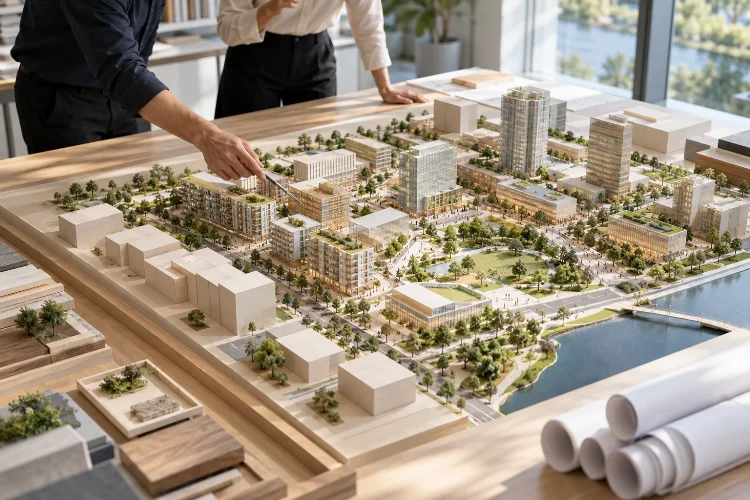
Imagine a district where people can grab coffee, walk to work, visit a park, and pick up groceries without spending half their day in traffic.
Sounds like a dream, right? Making that happen takes more than placing residential towers, shopping centres, and office buildings next to each other.
The real challenge lies in deciding how much land each activity needs, where those activities should go, and how they should interact. That’s why optimising land use allocation in complex mixed-use districts has become such an important part of modern urban planning.
Every square metre needs to contribute to a bigger picture that balances economic performance, community needs, mobility, and environmental sustainability.
As cities become denser and available land gets harder to find, traditional zoning approaches often struggle to deliver that balance. Planners need smarter, more adaptable strategies that consider how districts function throughout the day and evolve over time.
This guide explores practical ways to improve land use efficiency, organise different urban functions, and create mixed-use environments that are genuinely enjoyable to live in.
1. Why Land Use Allocation Is More Than Just Dividing Space
At first glance, land use allocation seems straightforward. You assign certain percentages of a development site to housing, offices, retail, roads, parks, and public facilities. Once everything adds up to 100%, the master plan looks complete.
Unfortunately, successful urban districts are rarely that simple.
A mixed-use neighbourhood operates like an interconnected ecosystem. Residential buildings create demand for shops and services, offices support daytime activity, and public spaces provide opportunities for social interaction.
When these components complement one another, the entire district becomes more functional.
Understanding the Difference Between Land Quantity and Land Quality
A large commercial zone doesn’t automatically create a successful business district. Its performance depends on accessibility, customer demand, surrounding activities, and how comfortably people can move through the area.
For example, placing retail units along a disconnected road may generate less activity than positioning smaller shops beside a busy pedestrian route. The second option could occupy less land while producing stronger commercial opportunities.
The US Environmental Protection Agency identifies mixed land uses, compact development, and walkable neighbourhoods as fundamental principles of smart growth.
This highlights an important lesson: land allocation should focus on relationships between activities rather than treating every land-use category independently.
Effective master planning also needs to distinguish between land area and building floor space. A residential-led parcel might include shops on the ground floor, offices above, and apartments on higher levels.
In other words, the land-use mix exists both horizontally across the district and vertically within individual buildings.
2. Start With a Detailed Understanding of the Site
Before deciding where buildings should go, planners need to understand what the site can realistically support.
Complex urban developments often involve irregular boundaries, different landowners, existing infrastructure, environmental restrictions, and surrounding communities with competing interests.
Ignoring these conditions early can result in expensive design revisions later.
Analyse Physical, Environmental, and Regulatory Constraints
A comprehensive site assessment should examine topography, drainage patterns, flood exposure, solar orientation, wind conditions, existing utilities, and transportation connections.
These factors influence where different activities are most suitable. A flood-prone area, for instance, may be better suited to a carefully designed water-management landscape than critical infrastructure or underground commercial facilities.
Regulatory conditions deserve equal attention. Local zoning restrictions, building height limits, floor area ratios, setbacks, and infrastructure requirements can significantly influence development capacity.
Using Geographic Information Systems (GIS), planners can overlay these datasets to identify opportunities and constraints. GIS-based suitability analysis makes it easier to compare potential development locations rather than relying entirely on visual assumptions.
Look Beyond the Development Boundary
A district doesn’t exist in isolation. Its success depends on the surrounding urban environment, including nearby transport stations, employment centres, schools, residential communities, and commercial corridors.
Suppose a proposed development sits beside an established office district but lacks everyday amenities. Introducing housing, affordable restaurants, childcare facilities, and recreational spaces may create more value than building additional offices.
Understanding the wider urban context prevents unnecessary duplication and helps new developments complement existing neighbourhood functions.
Community engagement is equally important. Residents and local businesses often identify mobility problems, service gaps, and cultural assets that technical surveys overlook.
3. Create a Balanced Land-Use Mix Based on Real Demand
One of the biggest mistakes in mixed-use master planning is assuming that every district needs the same combination of functions.
A site near a university has different requirements from a waterfront business district or a transport-oriented residential community.
The ideal balance depends on the target population, market demand, accessibility, and long-term economic opportunities.
Develop a Practical Land Allocation Framework
Consider a hypothetical 40-hectare mixed-use district planned around a public transport corridor.
An initial land allocation scenario might dedicate 30% to streets and mobility infrastructure, 28% to residential-led parcels, 18% to employment and retail-led development, 9% to civic and community facilities, and 15% to parks and green-blue infrastructure.
These percentages are illustrative, not universal planning standards. They describe horizontal land allocation, while individual development parcels may accommodate several building functions.
UN-Habitat’s sustainable neighbourhood planning principles provide a useful reference, including adequate street networks, density, mixed land uses, social diversity, and limited single-use specialisation.
The important thing is testing whether each allocation contributes to a coherent, accessible district.
Match Activities With Daily Urban Behaviour
Different activities attract people at different times.
Offices generate demand during working hours, restaurants become busier around meals, and residential areas support evening and weekend activity. Entertainment facilities can extend pedestrian movement beyond traditional business hours.
Combining these uses helps establish a more consistent flow of people throughout the day.
However, compatibility matters. Loud entertainment venues, loading areas, and late-night commercial operations may create conflicts when placed directly beside sensitive residential uses.
Thoughtful buffers, building orientation, servicing routes, and acoustic design can reduce these problems without separating activities completely.
A successful neigbourhood also needs space for smaller businesses, essential services, and affordable housing. Otherwise, even a visually impressive development may struggle to create an inclusive community.
4. Position Urban Density Where It Creates the Most Value
High-density development is often associated with tall buildings, but density optimisation involves much more than increasing building heights.
The real question is where additional floor space can deliver the greatest benefits without overwhelming surrounding infrastructure or reducing environmental quality.
Use Transit-Oriented Development as a Starting Point
Transit-oriented development (TOD) offers a useful framework for allocating higher densities around accessible public transportation.
The Institute for Transportation and Development Policy’s TOD Standard introduces eight principles: Walk, Cycle, Connect, Transit, Mix, Densify, Compact, and Shift.
These principles encourage compact urban environments where people can access daily activities without depending entirely on private vehicles.
The World Bank’s TOD implementation guidance also discusses concentrating development and diverse land uses within approximately five to ten minutes’ walking distance of mass transit stations.
In practice, this means locating higher-intensity offices, housing, and commercial activities near major transit nodes while allowing densities to transition towards surrounding neighbourhoods.
Evaluate Floor Area Ratio and Infrastructure Capacity
Floor area ratio (FAR) helps planners measure potential development intensity.
For example, a one-hectare parcel with an FAR of 4.0 could theoretically accommodate 40,000 square metres of gross floor area, subject to applicable local definitions and regulations.
But maximum permitted floor area doesn’t automatically mean maximum desirable development.
Infrastructure capacity, daylight access, pedestrian comfort, fire safety, and public facilities must all be considered.
Density gradients can help distribute development intensity more effectively. Taller buildings may cluster around transit stations or commercial centres, while medium-rise developments create transitions towards parks and lower-rise communities.
This approach allows urban density to support economic activity while maintaining a more comfortable human scale.
5. Make Mobility and Public Space the Foundation of the Master Plan
Land allocation decisions strongly influence how people move around a district.
A development might offer an excellent mix of residential, commercial, and recreational activities, yet still feel inconvenient if walking routes are disconnected or major roads create physical barriers.
That’s why mobility planning should shape the master plan from the beginning instead of being added after building plots are finalised.
Prioritise Pedestrian Connectivity
A connected street network allows people to travel between destinations using shorter, more direct routes.
Small urban blocks, frequent crossings, shaded sidewalks, and active ground-floor frontages can make walking more convenient and enjoyable.
The Global Street Design Guide published by NACTO and the Global Designing Cities Initiative provides guidance for designing streets around safety, accessibility, environmental quality, and urban activity.
Rather than treating streets exclusively as vehicle corridors, this approach recognises their role as valuable public spaces.
Improving walkabilty also requires attention to everyday conditions. Weather protection, lighting, universal accessibility, and comfortable pedestrian crossings can influence whether residents actually choose to walk.
Integrate Public Transport and Reduce Vehicle Dependence
Public transportation works best when stops are conveniently connected to surrounding destinations.
Residential clusters, workplaces, shopping areas, and public facilities should connect through clear pedestrian routes that minimise unnecessary detours.
Cycling infrastructure and secure bicycle parking can extend the effective reach of transit stations.
Parking allocation deserves particular attention because excessive parking can consume valuable land and encourage vehicle dependence.
Shared parking arrangements may reduce duplicated capacity where different activities experience peak demand at different times. However, the required supply should still be tested against local travel behaviour, accessibility, and regulations.
Treat Open Space as Essential Infrastructure
Public squares, neighbourhood parks, and landscaped pedestrian corridors should never be treated as leftover spaces between buildings.
They provide gathering places, improve environmental comfort, and strengthen connections between different land uses.
A well-positioned plaza beside a transit station and retail frontage, for example, can function as both a circulation space and a social destination.
6. Integrate Climate Resilience, Infrastructure, and Social Equity
Efficient land allocation shouldn’t focus exclusively on development yield.
Modern mixed-use districts also need to respond to climate risks, infrastructure limitations, and the needs of diverse communities.
These factors can determine whether a project remains successful decades after completion.
Use Green-Blue Infrastructure Strategically
Green-blue infrastructure combines vegetation, open space, water systems, and natural drainage features to improve urban environmental performance.
Examples include rain gardens, bioswales, permeable surfaces, retention ponds, and connected green corridors.
The EPA’s Land Use and Green Infrastructure Scorecard highlights how planning policies can support water-resource protection, flood mitigation, public health, and broader ecosystem benefits.
Instead of reserving stormwater infrastructure for isolated technical zones, planners can integrate it with parks, pedestrian networks, and recreational landscapes.
A landscaped drainage corridor, for instance, may provide flood storage during heavy rainfall while functioning as a public greenway during normal conditions.
These multifunctional spaces can improve land efficiency without compromising essential environmental performance.
Plan for Social Infrastructure and Affordability
Mixed-use districts aren’t complete simply because they contain homes, offices, and shops.
Residents also need access to schools, healthcare, childcare, affordable food, public transport, and community facilities.
These services should be distributed according to population needs and realistic walking distances.
Housing diversity is equally important. Incorporating different dwelling sizes, price points, and tenure options can help accommodate households with varied incomes and lifestyles.
Planners should also consider displacement risks, especially when redevelopment increases land values around existing communities.
The World Bank has explored land value capture mechanisms that can help finance transport infrastructure and potentially support public facilities and services.
Careful coordination between public authorities, developers, and communities is essential to ensure that development benefits extend beyond property owners and investors.
7. Test Multiple Development Scenarios and Plan for Long-Term Flexibility
Even a carefully researched master plan involves uncertainty.
Property markets change, transport systems expand, climate conditions evolve, and community expectations shift over time.
The strongest land use strategies therefore combine evidence-based decisions with enough flexibility to respond to future conditions.
Compare Alternative Land Allocation Scenarios
Instead of committing immediately to one development layout, planners should examine several options.
One scenario might prioritise residential development, another could allocate more floor space to commercial activity, while a third may emphasise transit accessibility and public space.
Each option should be assessed against consistent criteria.
A practical evaluation framework could assign illustrative weights of 25% to accessibility, 20% to market viability, 20% to environmental and infrastructure performance, 20% to social benefits, and 15% to adaptability.
These weights should reflect local objectives rather than being treated as a universal formula.
Importantly, serious constraints such as flood safety, minimum service capacity, and regulatory compliance should remain mandatory requirements instead of being traded away for higher scores elsewhere.
Digital modelling tools can support this process by estimating development capacity, pedestrian accessibility, infrastructure demand, shadow impacts, and other measurable outcomes.
Use Development Phasing to Reduce Risk
Large mixed-use districts are rarely completed in a single construction phase.
A successful phasing strategy identifies which components need to become operational first and how later development can build on that initial investment.
For example, the first phase might prioritise essential infrastructure, public space, residential development, and a modest retail offering near a transport connection.
Later phases could expand employment space, cultural facilities, and commercial activity as demand increases.
This reduces the risk of creating empty shopping streets or oversized office districts before a sufficient customer or employment base exists.
The sequence should also protect future infrastructure corridors and public facilities from being occupied by short-term uses that become difficult to relocate.
Allow Buildings and Plots to Evolve
Long-term adaptability is an important part of urban resilience.
Flexible building layouts, appropriate structural grids, adaptable ground-floor spaces, and carefully planned utility connections can support changes in function over time.
A ground-floor commercial unit might eventually become a childcare centre, community workspace, or healthcare facility if local demand changes.
Similarly, a temporarily landscaped plot can provide public value before its planned development phase begins.
Achieving this flexibility requires ongoing coordintation between planners, architects, infrastructure engineers, investors, and local authorities.
The goal isn’t to predict every future requirement perfectly. It’s to establish a framework that can respond to change without undermining the district’s overall structure.
Optimising land use allocation in complex mixed-use districts is about creating better relationships between people, buildings, activities, and the urban environment.
Successful master planning starts with understanding site conditions and market demand, then balances development density with accessible transport, public space, infrastructure capacity, and community facilities.
Equally important, it leaves room for changing needs and future investment.
There’s no single land-use percentage that guarantees a successful district. The best allocation is one that responds to local conditions while improving accessibility, economic vitality, environmental resilience, and everyday quality of life.
Planning a new mixed-use development or upgrading an existing district? Start by reviewing your land-use assumptions, testing alternative scenarios, and measuring how well each option serves the people who will actually use the space.
A smarter allocation today can create a more valuable, adaptable, and liveable urban district tomorrow.